Himachal Pradesh Geography
Comprehensive Overview of Himachal Pradesh Geography
Himachal Pradesh, a northern state in India, is renowned for its diverse and dramatic geographical features. Understanding the geography of Himachal Pradesh is essential for government exam aspirants, as it frequently appears in competitive exams. Here is an in-depth look at the geographical features, climatic zones, and special climatic phenomena of Himachal Pradesh.
Geographical Boundaries and Elevation
- Boundaries:
- North: Jammu & Kashmir
- Northeast: Tibet
- South: Uttarakhand
- Southeast: Haryana
- West: Punjab
- Altitude: The state’s elevation varies significantly, ranging from 350 meters in the lower valleys to over 7,000 meters in the highest peaks. The general elevation increases from west to east, with the western regions featuring lower altitudes and the eastern regions reaching greater heights.
- Historical Context: Historically known as Jallandhara, the region’s name derives from “Jalam” (water) and “Dhara” (that which holds), due to the presence of several major rivers. According to the Padma Purana, Jallandhara was the son of the ocean (Sagara) and Ganga.
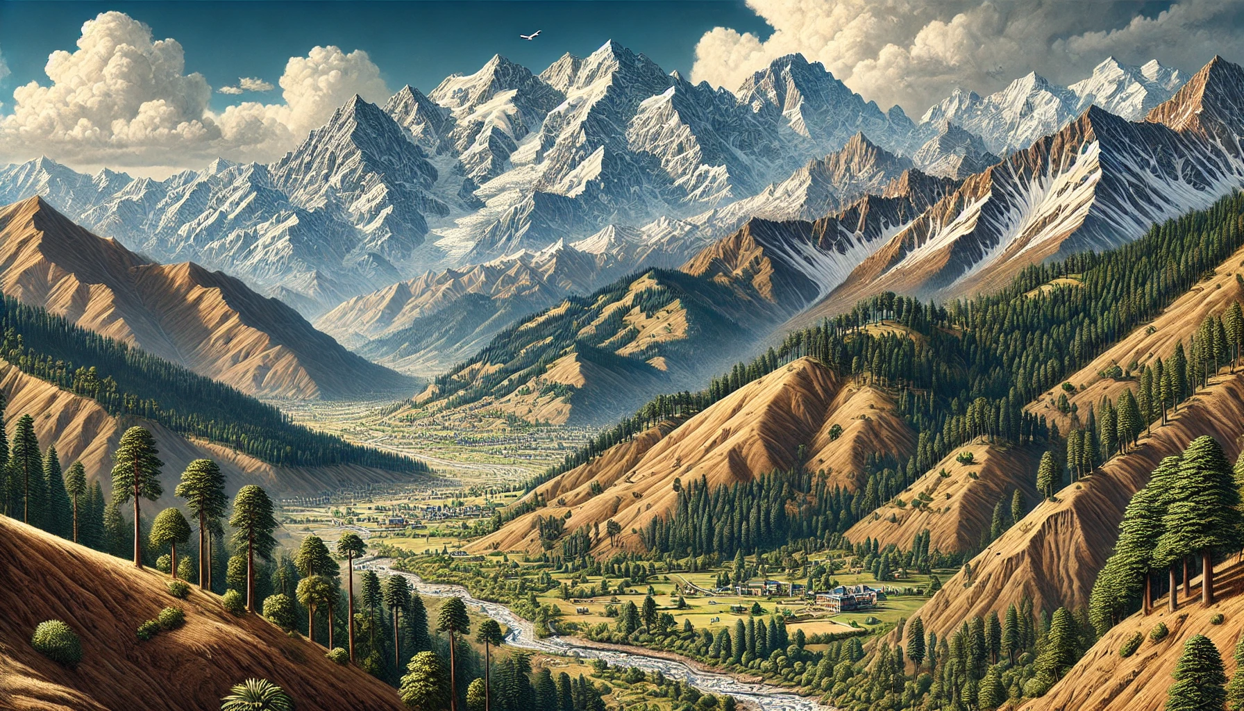
Geographical Zones of Himachal Pradesh
Himachal Pradesh’s topography can be divided into three primary geographical zones, each with distinct features:
- Shivaliks (Outer Range)
- Altitude: 350 meters to 1,500 meters.
- Rainfall: 150 cm to 180 cm annually.
- Regions: Includes parts of Kangra, Hamirpur, Bilaspur, Una, Mandi, Solan, and Sirmaur.
- Characteristics: Known as “Manak Parbat” or “Tresses of Shiva”, this range features a relatively low elevation and is characterized by lush greenery. Key areas in this zone include the Paonta Valley, Nahan, Pachhad, and Renuka in Sirmaur.
- Inner Himalayas
- Altitude: 1,500 meters to 4,500 meters.
- Major Ranges: Includes the Dhauladhar and Pir Panjal ranges.
- Regions: Covers Renuka tehsil, Chachiot, Karsog in Mandi, Dalhousie, Shimla, and Choordhar (3,647 meters), and the Kullu Valley.
- Dhauladhar Range: Also known as “Maulak Parbat”, it extends through Chamba, Kangra, and Mandi. It branches from the Great Himalayas near Badrinath and is intercepted by rivers like Satluj, Beas, and Ravi, forming a significant water divide.
- Greater Himalayas
- Altitude: 4,500 meters to 7,000 meters.
- Major Ranges: Includes the Zanskar Range, which separates Spiti and Kinnaur from Tibet. Notable peaks include Shilla (7,025 meters) and Riwo (Liwo) Pargyul (6,791 meters).
- Characteristics: This range is characterized by its arid climate, suitable for dry fruit cultivation. It also features several important passes, including Sach, Chini, Chabia, and Kugti Passes in Chamba, as well as the Hamta Pass connecting Manali to Lahaul and Chandarkhernt Pass connecting Naggar to Malana.
Physiographic Zones
Himachal Pradesh’s diverse topography results in several distinct physiographic zones:
- Wet Sub-temperate Zone
- Regions: Palampur, Joginder Nagar, Dalhousie, and Dharmshala.
- Characteristics: Characterized by high rainfall and lush vegetation, this zone enjoys a relatively mild climate.
- Humid Sub-temperate Zone
- Regions: Kullu, Shimla, parts of Mandi, Solan, Chamba, Kangra, and Sirmaur.
- Characteristics: This zone experiences moderate rainfall and features a diverse range of vegetation.
- Dry Temperate Zone
- Regions: Alpine high parts of Lahaul, Spiti, Pangi, and Kinnaur.
- Characteristics: Known for its low rainfall and dry climate, this zone is ideal for dry fruit cultivation.
- Humid Sub-tropical Zone
- Regions: Mandi, Nahan, Nalagarh, Nurpur.
- Characteristics: This zone has moderate to high rainfall and a variety of vegetation.
- Sub-humid Tropical Zone
- Regions: Una, Paonta Sahib, Indora area of Kangra.
- Characteristics: This zone is relatively dry, with seasonal variations in rainfall.
Special Climatic Phenomena
Several unique climatic phenomena affect the weather patterns in Himachal Pradesh:
- Gravity Winds: Vertical movements of air resulting from temperature changes throughout the day. These winds move from the ridge tops to the valley bottoms after sunset.
- Western Disturbances: Mid-latitude westerly winds that influence the western Himalayas, bringing winter precipitation and affecting weather patterns.
- Jet Streams: High-speed winds in the upper atmosphere, primarily during winter, that develop narrow belts and influence regional weather.
- Lee Waves: Strong winds occurring on the leeward side of mountains, which can cause significant erosion and damage.
- Southwest Monsoon: Responsible for the maximum rainfall in the Himalayas, this seasonal wind system affects the region’s precipitation patterns.
- Winter Monsoon: Similar to the northeast trade winds, it influences the region’s weather during winter.
Here are 25 MCQs related to the geography of Himachal Pradesh:
1. Which of the following is the highest peak in Himachal Pradesh?
a) Shilla
b) Reo Purgyil
c) Kinner Kailash
d) Manimahesh Kailash
Answer: b) Reo Purgyil
2. The Great Himalayan National Park is located in which district of Himachal Pradesh?
a) Kangra
b) Kullu
c) Chamba
d) Shimla
Answer: b) Kullu
3. Which river forms the southern boundary of Himachal Pradesh?
a) Yamuna
b) Sutlej
c) Beas
d) Ravi
Answer: a) Yamuna
4. Which of the following passes connects Kullu and Lahaul valleys?
a) Rohtang Pass
b) Baralacha La
c) Kunzum Pass
d) Shipki La
Answer: a) Rohtang Pass
5. The Spiti Valley is located in which district of Himachal Pradesh?
a) Lahaul and Spiti
b) Mandi
c) Kangra
d) Bilaspur
Answer: a) Lahaul and Spiti
6. Which lake in Himachal Pradesh is considered the source of the river Ravi?
a) Renuka Lake
b) Rewalsar Lake
c) Suraj Tal
d) Manimahesh Lake
Answer: d) Manimahesh Lake
7. The Dhauladhar Range is located in which part of Himachal Pradesh?
a) Northern
b) Western
c) Eastern
d) Southern
Answer: b) Western
8. Which of the following valleys is known as the ‘Valley of Gods’?
a) Kinnaur Valley
b) Lahaul Valley
c) Kullu Valley
d) Chamba Valley
Answer: c) Kullu Valley
9. The famous Hidimba Devi Temple is located in which town?
a) Shimla
b) Manali
c) Dharamshala
d) Dalhousie
Answer: b) Manali
10. The Kalka-Shimla railway line is a UNESCO World Heritage Site under which category?
a) Mountain Railways of India
b) Cultural Heritage of India
c) Architectural Heritage
d) Natural World Heritage
Answer: a) Mountain Railways of India
11. Which district in Himachal Pradesh is famous for apple orchards?
a) Mandi
b) Kinnaur
c) Kangra
d) Sirmaur
Answer: b) Kinnaur
12. Which of the following rivers is the largest in terms of length in Himachal Pradesh?
a) Sutlej
b) Beas
c) Ravi
d) Yamuna
Answer: a) Sutlej
13. Which sanctuary in Himachal Pradesh is famous for its population of the Snow Leopard?
a) Pin Valley National Park
b) Renuka Wildlife Sanctuary
c) Kibber Wildlife Sanctuary
d) Kalatop Wildlife Sanctuary
Answer: a) Pin Valley National Park
14. In which district is the famous Parvati Valley located?
a) Mandi
b) Kullu
c) Solan
d) Chamba
Answer: b) Kullu
15. The river Pabbar is a tributary of which major river system?
a) Sutlej
b) Yamuna
c) Beas
d) Ravi
Answer: b) Yamuna
16. Which of the following places is famous for Tibetan culture and the residence of the Dalai Lama?
a) Manali
b) Dalhousie
c) Dharamshala
d) Kasauli
Answer: c) Dharamshala
17. Which pass is the highest motorable pass in Himachal Pradesh?
a) Rohtang Pass
b) Baralacha La
c) Kunzum Pass
d) Shipki La
Answer: b) Baralacha La
18. The Renuka Lake is located in which district of Himachal Pradesh?
a) Kangra
b) Sirmaur
c) Kullu
d) Shimla
Answer: b) Sirmaur
19. Which of the following rivers originates from the Rohtang Pass?
a) Ravi
b) Beas
c) Chenab
d) Sutlej
Answer: b) Beas
20. The Chamera Dam is built on which river in Himachal Pradesh?
a) Ravi
b) Beas
c) Sutlej
d) Yamuna
Answer: a) Ravi
21. The town of Dalhousie is located in which district of Himachal Pradesh?
a) Kangra
b) Chamba
c) Shimla
d) Solan
Answer: b) Chamba
22. Which region in Himachal Pradesh is famous for traditional Buddhist monasteries?
a) Kullu Valley
b) Spiti Valley
c) Kangra Valley
d) Mandi Valley
Answer: b) Spiti Valley
23. The Pong Dam, a major reservoir for irrigation and hydroelectric power, is built on which river?
a) Ravi
b) Beas
c) Sutlej
d) Chenab
Answer: b) Beas
24. Which of the following towns is known as the “Gateway to Spiti”?
a) Manali
b) Kaza
c) Reckong Peo
d) Rampur
Answer: d) Rampur
25. The Solang Valley, a popular destination for skiing and adventure sports, is located near which town?
a) Kullu
b) Manali
c) Dharamshala
d) Dalhousie
Answer: b) Manali
These MCQs provide a broad overview of the geographical features, rivers, passes, valleys, and important tourist destinations of Himachal Pradesh.
Key Points for Exam Preparation
- Altitude and Zonal Variations: Understanding the altitude variations and geographical zones is crucial for answering questions on physical geography and climate.
- Historical Significance: Knowledge of historical names and their significance enhances understanding of regional geography.
- Climatic Phenomena: Familiarity with special climatic phenomena and their effects on the region aids in answering questions related to weather patterns and their impacts.
By mastering these details, exam aspirants can effectively prepare for questions related to the geography of Himachal Pradesh, improving their chances of success in competitive exams.
Also Read :
Lakes in Himachal Pradesh -
[…] Himachal Pradesh Geography […]